
Translating place-names is a
complicated task. The originals are short and, though I approach them as poems,
there’s more leeway with a haiku or couplet. Place-names have special
characteristics – they are plastic texts that tend to contract over time.
Sometimes folk tradition creates two names for a place, as with this burn,
preserved on the 1st edition one inch and six inch maps in slightly
different forms:
Allt Coire Ghiubhais
Allt Coire Giubhsachan
Pine Corrie Burn
Names such as Coire Giubhachan, Druim na Giùthsaich (NN070888), Pinewood Ridge; Allt
Giubhais (from An t-Allt Giuthais, NN197985), Pines’ Burn; and Adhbrann Allt a' Ghiuthais (NN080990),
Pine Burn Ankle, are a reminder of
the work Trees for Life and other planters have undertaken. Without a deer cull
then the remediation of the Caledonian forest can only be enforced with the
help of the massive and counter-productive infrastructure of deer fences. This struggle, to balance deer and trees in the Highlands,
is not new; ‘Deer Forest Problems’,
an essay published in Country Life in 1936, includes a plea for
a complete revision of practices, and a recognition that, even from the
stalking point of view, deer will never thrive “without the return of the woods.”
“The
sight of a lot of stags hard pressed against the wire fences on the lee side of
plantation of young larch or Scots firs serves only to emphasise the poverty of
the substitute for natural conditions in those places where some remnant of
primeval forest remains.”

Càrn nan Earb, translation, Alec Finlay, drawing Hanna
Tuulikki
Names are disguised when Gaelic is brought over into Scots. For
instance, the Scots Badcaul is a garment wrapped around the Gaelic Am Bada Call (NH458302), originally translated as The Hazel Clump. Out of dislike for that word as a descriptor, I opted for dene.
Hazeldene
Badcaul
Dene, dean, den, is a toponym that
crosses the Scottish Lowlands and northern England. It’s familiar meaning is: rivulet
within a sloping hollow;
wooded ravine, valley, or dingle. Jesmond Dene was a place for
Sunday walks when I lived in Byker. The meaning slips in Eastern and Southern
England. There dene, dune, dun, is embedded in place-names, marking the imprint of Norse
settlers. In these cases the Scandinavian refers to sand dunes. Meaning is
local: one community experiences slopes and dips as dune, dene, another as dene, dean, ravines. In a few places the two could conceivably coincide?
Confusingly, dùn, which is well known
as fort, but can also refer to a look-alike fort-like hilltop, is a third
possibility in regions where Gaelic once held currency. A few streets from my home in
Edinburgh there are signs for the Dean Village and, nearby, Dene Walk – even
the city of Enlightenment names escapes standardisation.
In my
translations – versions would be the more accurate term if these were
acknowledged to be poems – dene joins
other English terms, such as spinney
or copse. These descriptors don’t
belong in the linguistic ecology of the Scottish Highlands, but they do create vivid
images. Any translator of a poem is familiar with such trade offs.
For
the same reason place seems to me to
be too neutral for achadh. The wonderful
Scots name, Shewglie, seems to be asking to be imagined as a bog, like the
various waggle place-names one finds in the North-east, but it is, in fact,
from Ach' an t-Seagail, more formally Achadh an t-Seagail, Rye Place, or Field of Rye (NH416297). Such names are
examples of the way in which, over generations, speech steers place-names into
new forms.

Dundreggan: photograph Alice Ladenburg
A name is nothing more than a
sequence of sounds, and the ways that communities speak changes, inevitably,
over time, as we know from claims that Shakespearean speeches were flecked with
a variation of Brummy. In the
Highlands languages have their eras, with Pictish, Gaelic, Norse, Scots, and
English co-existing or conflicting at different times, leeching useful terms
for trade, topography and courtship through the language barrier. Names are a
palimpsest of these histories and provide historical evidence for the flux of
border territories – the lack
of Norse names confirms the Vikings never had a strong presence in Upper Deeside.
The couthy –ie ending of Shewglie, Livishie, Glenmallie, Coiltie, Cougie, Kingie, have a tell-tale fond ring of Gaelic brought over
into Scots, but it takes an expert in onomastics and Gaelic to re-expand the
name into its original form, travelling back through time and elucidating the
yield of significance. Many names remain a puzzle, and sometimes competing
interpretations offer themselves as poetic images.
Another
achadh name is Coinneachan, given
confusingly as The Place of
the Foggy Bee by Edward Ellice in his Place-names
in Glengarry and Glenquoich, but more likely to have been An Còinneachan, The Mossy Place (NN203847), or, to
ditch that place.
Ryebit
Shewglie
Mossybit
Coinneachan
With both achadh names I have diverged from the
convention, perhaps too far for some, preferring a dialect toponym from the Scots of my childhood: bit,
as in, “are you coming over to my bit
tonight?”.
The ever-helpful Dwelly offers some
alternatives, useful if one knows whether the terrain is a field, plain, or meadow:
“achadh: -aidh, pl -aidhean,
aidhnean, & achanna, sm Field,
plain, meadow. Cornfield newly cut or ready for reaping. Bha sinn a' ceangal
sguab san achadh, we were binding sheaves in the field; an
t-achadh a cheannaich Abraham, the field that Abraham bought.”
Bit is my attempt at local colour. An
eco-poetic approach to names should stress diversity in vocabulary as well as
trees and mammals. I’ve approached the translations as an opportunity to share
new toponym – John Murray’s Reading the
Gaelic Landscape is the ideal guide for those interested in taking this
further.

Allt Coinneag, Wild Bee Burn
There are other oddities in terms
of place-names. Allt Coinneag may well be Wild
Bee Burn, but the name could also refer to pools, for this is a spate burn,
or moss, as at Coinneachan. One of the sources I referred to gave Loch Cuileig
(NH268151) as Fly Agaric Loch, which
is nonsense. It just applies to flies, and its natural to assume midges, meanbh-chuileag in Gaelic – literally little fly – Highland toponymy. There is a
Meall Cuileige, The Lumpy Hill of the Fly,
above Glen Moriston, but in the few names in which it occurs, cuileag is more
often associated with water – allt, abhainn, caochan. The loch fits into that
pattern.
Flies Loch
Loch
Cuileig
Were midges less
common? Is there any relation to ticks, whose numbers have soared due to the
unsustainable numbers of sheep on the hill, bringing with them serious medical
concerns.
Minnows’ Loch
Loch na Doirb
Charr Loch
Loch nam Breac Dearg
There is a more definite
sense of species in these two lochs, Loch na Doirb (NH533248), south of Ballaggan, and Loch nam Breac Dearg (NH454225), west of
Loch Ness. The Gaelic, Breac Dearg
translates as Red Trout, but this
name refers to what, in English, we call charr.

Dragon Mead
Dundreggan
Dragons are another matter
altogether. Working on a translation of Dundreggan (NH315140), home of Trees for Life, I was told that Duldreggan was the spelling in 1509. The
first element may be a corrupt form of the Gaelic dail, sharing a meaning with the Brittonic dot,
meadow, low fertile spot, dale. The dragon
element of Dundreggan is sometimes said to derive from a personal name.
I liked
the simplicity of mead for meadow from one of the historical sources, though as
Peadar points out haugh would be more
conventional. That shift away from the expected helps lessen the too gentle air
of lowland pastoral that the word meadow tends to frame. With a Bioregion such
as the Highlands it’s important to shift the register of names to reflect the
harsh conditions. A friend did point out that the result, Dragon’s Mead, sounds a bit too like a Harry Potteresque drink, but
doesn’t JK Rowling’s imagination draw on Highland ecology and the totemic
presence of the relic Scots pines that make the wee islands on Loch Eilt so magical? And it belongs in an
organization which has earned the sponsorship of the Order of Bards, Ovates and
Druids.

Another example where Peadar and
I introduced a less common local term is the Scots garron, from Gaelic, gearran
–
seemingly corrupted to Geur-oirean in the name:
Garrons Corrie Head
Mullach
Coire nan Geur-oirean
Mullach Coire nan Geur-oirean (NH295070), Head of the Horses Hollow, is a couple of miles north-west of Glenmallie. It would have been a place where hardy Highland ponies roamed
free out on the hill. I found a host of these names in the stalking heartlands
of upper Deeside.
Easg
Chapall
Mares Bog
Féith
Shearrach
Colts’ Vein
Lag an
t-Searraich
Colt’s Dip
Féith
Preas an Eich Bhlàir
Vein of the White-faced Horse’s
Thicket
Cuachan
Craggana Shearrach
Foals-crag Burnie
Allt
Clais an Eich
Horse-hollow Burn
Coire Odhar nan
Each
Dun-coloured Corrie of the Ponies
Bad-each
Horses Thicket

Garron, Glen Isla: photography
Hannah Devereux, 2015
Garron can find their way into bogs where no Land Rover dares
and, in recent years, they have become popular again, especially on stalking
estates, where they add a sense of tradition.
I have a vague memory of the word from childhood, appearing in the
opening scene of Bannockburn. Histories tell how Bruce rode an unarmoured
garron, using its nippiness to kill De Bohun on his ponderous mighty steed.
Peadar notes that Mullach Coire nan Geur-oirean could be read differently, as it
superficially means The Top of the Corrie
of the Sharp-edges.
THE TOP :
MULLACH

Another complicating factor in
translating place-names is maps themselves. Gaelic names may be ‘incorrect’
because local dialects had evolved beyond standard orthography. The problems
weren’t always the fault of ‘sassenach’ mapmakers, ignorant of the native
culture. Some names were transcribed incorrectly, and perhaps the odd informant
deliberately gave incorrect information. John Murray notes that some Victorian mapmakers
used phonetic spelling, avoiding the Gaelic
conventions. There would have been some argument for this if their grasp of
phonetics had been expert, as a way to maintain the patterns, patter and patina
of speech.
In recent years the Ordnance Survey have made an effort to remedy past
failings with respect to Gaelic. My collaborator, Peadar Morgan, helped
persuade them to change a number of incorrect spellings, including some well
known places, such as Gleann Einich, which now appears in line with the local
Gaelic tradition as Gleann Eanaich in maps of the Cairngorms. The correct
pronunciation is glown ENich, Glen of the
Boggy Place, or, by my way of it, Boggybit
Glen.

Peadar and his peers encourage the OS to use modern
Gaelic orthography. For instance, the approved spelling for mountain ash is
caorann, of the ash, a’ chaorainn, but the old OS name books record Allt a’
Chaoruinn (NH191031), Rowan Burn, which flows down to Loch Garry from Meall
Leac Ulaidh. The spelling has been ‘corrected’, but care is needed when
imposing standardisation. On occasion old spellings hint at local dialect, and
the tongue is key in unlocking the original meaning of a place-name. An expert
has to be able to tell a mistake from a meaningful local variation.
Against the plea for allowing slight variances in
dialect there stands the need to firmly maintain Gaelic as a contemporary
language, held to the same exacting standards as General English.

In our map area another example
of these variations in spelling is aobran,
which contemporary Gaelic Orthographic Convention
gives as adhbrann.
Pine Burn Ankle
Adhbrann Allt a' Ghiuthais

Traditionalists tend to respect
Gaelic word order, but I prefer to bring names over into English, in the same
way as a translator of a poem would. I’m keen to share the old style of
translations in these blog posts – the idea isn’t to supplant them, but to encourage
different approaches, and experiment with different imagery, to better suggest
the eco-poetic aspect.
With place-names there are tiny
things to worry about. Apostrophes. I struggle with them at the best of times,
but by changing the old way of presenting a Gaelic name in English, I left
myself with even more of a puzzle apostrophe-wise:
The
Burn of the Wolf
Wolf’s Burn, Wolfsburn, Wolves’
Burn
The
Hill of the Hinds
Hind’s Hill, Hinds’ Hill, Hinds
Hill
With each draft the apostrophes came
and went, like swifts flying in-and-out of a barn.
Fir[‘](s) & Pine[‘](s)
With Gaelic the room
for confusion between singular and plural is limited, more so than in English
so, as Peadar says, the issue is simply one of interpretation – and only in one
direction, singular to plural, not the reverse.
There is a temptation to settle
on intuitive interpretations, based on species.

Commonsense suggests one wolf in its
lair, whose presence settled into a name – perhaps over generations of wolves who
patrolled the same location. Ravens always flock in their noisy dark plurality.
Many buttercups. Woods of aspen, birch and a burnside of willow. A single
eagle.
Sometimes
place-names are all that remain of a lost wood. Names don’t work as effective
headcounts. WFH Nicolaisen argued that, with
trees at least, names refer to the few more often that they do the many – a
scattering of juniper, a handful of rowan, a line of hazel, standing out like a
brocade woven over the mass of the ecological curtain – heather, scree,
moorgrass, or fir. This is perplexing for the ecologist who hopes that a name
is an indication of quantity, but, consider for a moment, how we use names for
those most endearing to us, whether pets or lovers?

In the end I removed the apostrophes,
following the modern style of signage – minimal text aids comprehension.
Plovers Burn
Allt
na Feadaige
Surely a flock of plovers is calling by the Allt na Feadaige (NN245965), below Beinn Tee? Even if we can agree whether the name signifies plovers,
plover’s, or plovers’, there are other problems, or possibilities, to consider.
Peadar notes that the Gaelic feadag could be a local twist of feadan – a wonderfully poetic description for a
channel or runnel in the hillside. The image is of a chanter, true to the way
the breeze whistles through, which
would give Allt
na Feadaige as Chanter Burn.
In its uncertainties, the name of
this modest and overlooked burn metamorphoses from the achingly sweet call of
the plover to the plaintive urlar of
the chanter.

Another name whose imagery is,
seemingly, sound-based is Allt a’ Chrannachain (NN488886?), which I
give as Churning Burn. In his studies
Peadar favours crannachan,
churn. Then there is cranachan, the well-known dessert of whipped cream,
berries, honey, whiskey and oatmeal. The master of Gaelic place-names, WJ
Watson, refers to Cruithneachan,
Pictish-place, in Lochaber, by which
he probably meant this location. There is a fourth possibility creaneachan, small market, and a
fifth, crannachan, The Place of
Tall Trees, or a sixth,
crithneachan, Place of Aspen Trees –
in my way of it, Aspen Bit.
What to do? The expert weighs the evidence – the letters in their
recorded combinations, the location, maps, wills, deeds, and local dialect.
First off, there was unlikely to have ever been a market in such a remote
location, so strike that option. Next, survey the ecology, see if there are still
trees – are they aspens, or would the land ever have been friendly to them?
My translation emphasizes a churning watercourse. I may be wrong;
perhaps a bowl-like pool is the closer image? Or does the river churn in the
churn? Sometimes a name is easier to puzzled-out by walking than reading.
Allt a’ Mheil (NH046031) seems a good pair for Allt a’ Chrannachain.
Allt
a’ Mheil
Bleating Burn
More sounds for the toponymic jukebox: given as Burn of Bleating, or of the bleat, Allt a’ Mheil flows into Loch Quoich a mile east of Glenquoich Lodge. Peadar notes
that, while the translation may seem straightforward, mèil is feminine, so the name produced should be Allt na Mèil.
It could also be a contraction from Allt a' Mheilidh, which would give The Grinding Burn. Both name-images give
a sense of the power of water, but the poetry shifts from a note of pleading to
a surging force. My partner, Hanna, once rescued a lamb from a burn on Skye
whose name meant wool, for the white rills like tresses.

Allt a’
Choire Bhuidhe
Yellowy Corrie Burn
the rock
takes
little steps
the
water makes
little falls
Some names are easier to
translate, but for our purposes, they remain ecologically inexact.
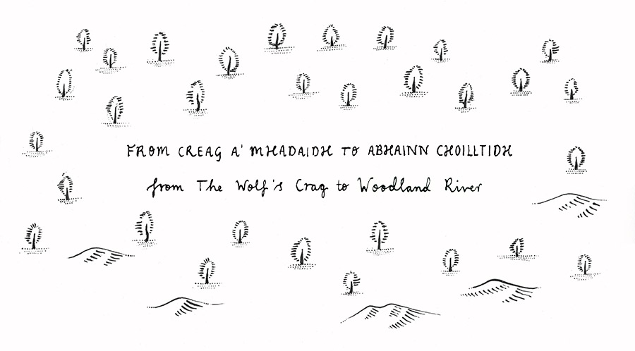
Wooded River
River Coiltie
The conventional translation is River of the Place of Woods. The Coiltie (NH480274) derives from
Abhainn Coilltidh and, if some Gaelic campaigners had their way, this name
would be returned to the map. It’s no harder for me, as an English speaker, to
say, once I get used to the dh sound, and there are guides for that.
Peadar gave me the correct pronunciation, ee, and corrected my original
plural, Woodlands, suggesting the meaning might be closer to Wood-place, or Wooded-one, referring to the river, which Gaelic culture perceived
as animate. What we still don’t know, from the name, is the tree species –
something more varied than the Forestry Commission plantation that now
dominates.

Alder Scar
A' Chlais Fheàrna
Fheàrna, grammatically from feàrna, is easy, alder. My original version of A' Chlais Fheàrna (NM865765), was The Alder
Groove. Chlais, from clais, is
a difficult toponym to translate. The most
famous example is the odd geological formation formed by a fault, in The
Cairngorms, Clais Fhearnaig. Our alders and their groove are by Loch Shiel. Peadar
preferred the conventional hollow, or
ditch – the form is an extended
depression, whether natural or man-made.
I’ve also seen it given as furrow, cleft, or rift in rocky
ground, with the logic that it offered a route to climb up by, like a bealach but steeper. Scar was
my final choice, from skōr, Old Norse, familiar from a
skerry, but also describing a hollow in the seabed.
Thorns Burn
Allt
a’ Bhiora
Oakburn Stake
Stob an Uillt Daraich
Birch Face
Leitir Beithe
Allt a’ Bhiora (NH222033) rises in Coire Àrd Acha and flows south to Loch
Garry. It is given
as The Burn of the Thorn Bushes, but the meaning could also be given in a vaguer form,
paradoxically to be more accurate; perhaps Stream of
the Spike(s), as the Gaelic, bior, applies to any sharp-pointed thing, including a pinnacle.
Peadar agreed the likelihood is hawthorn, or possibly blackthorn, but we left
the species open.
Like cairn (càrn), craig (creag),
glen (glean) and knock (cnoc), stob is one of the Gaelic toponym that have come over into
English. The oaks of Stob an Uillt Daraich (NM926657) grow – or grew, I haven’t been back to
check, but this is rugged land – on a hill that climbs to a point. I preferred
the alternate, stake, to keep the connection with the
English usage.
Leitir Beithe (NH255214), near Cougie, is definitely birch. The toponym
is leitir, pronounced LEHtchir – well known from letter- place-names, such as
Letterfinlay – is typically a steep slope with no opposite
slope mirroring it.
thin thoughts :
birches

A more pastoral name is Strathnacro (NH463298), in the
gentler stretches of Glen Urquhart, from
Srath nan Cnò. It
is handily placed near a farm called Hazelwood, and another we are already
familiar with, my Hazeldene, Badcaul, so we have enough clues to realise what is being referred
to:
Strathnacrò
Strath-of-the-nuts
Goldburn
Allt an Òir
Imprecision clouds the luster of Allt an Òir (NN167822), a
burn rising on Crom na Lice, reaching the River Lochy opposite Moy. The literal
English meaning is The Burn of (the) Gold,
though,
as Peadar notes, the interpretation is open – deposits of the metal, the
colour of the water or vegetation on the bank. We would need to do more
research to ascertain if gold(en)
is ever used descriptively in Gaelic place-names.

Even a straightforward name,
such as Aonach Shasuinn (NH173180), is puzzling, if one
considers the historical record.
Saxons’ Ridge
Aonach Shasuinn
Sassenach will bring a wry smile to some but, again,
the firm ground turns to quag, as Peadar explains:
“The
name relates to a folktale purporting to describe incidents during the
fourteenth-century campaigns of Edward I of England. The large hill of Aonach
Shasuinn, amidst generally hilly terrain, is said to mark the furthest point
north reached by the English forces, an unlikely motivation for naming. Glen
Sassunn is improbably said to have been the route into Rannoch taken by English
troops before the battle locally claimed to have been fought at Bunrannoch.”
Superficially, the name now means England's
steep-sided ridge, but the country-name is more likely to be a corruption of
Early Gaelic Saxa, meaning associated
with Saxons (whoever was meant by that). Names are tricky because they evolve
with speech, and we always wish to have a meaning to explain their meaning,
but, traversing the slow passage of time, our memories prove faulty. We are
constantly being reminded of a time when people were more present on the hill,
hunting, droving, souming, or raiding. Stone walls and the flush of green
patches where cow shit once fell are the obvious traces of dwelling. Sometimes
the rule was transience.

Tent Tump
Meall a’ Phùbuill
Meall
a' Phùbuill (NN030855)
is The Hill
of the Tent. The modern implication of pùball
is a pavilion, marquee, but, as grand as the old chief’s hunting trips may have
been, I would think of them more as benders. This is Albert
Bil, in his essay ‘Perthshire Shieling’:
“There are no clues in the historical records when tents were
abandoned in favour of bothy huts by ordinary folk, but in the
first half of the 18th century landowners still used tents on hunting forays in
the remote hills, away from the shieling settlements. In 1732, while on
a summer hunting trip in Glentatnich, Lord George Murray wrote to his wife: 'I
want a quarter of an ell of Teiken to mende a part of my tent.' A few years
later another gentleman, Graham of Fintry, went to the Atholl high tops near
the Aberdeenshire boundary 'with my company, tents and dogs' and'a shelty
carrying a small tent'”
Pùball is also one of the Gaelic
terms for butterbur, used to treat
fever, spasms and pain, properties that would make a place worth naming. I will
end this survey with an everyday shieling name, as a reminder that, although
names can be linguistically diverse and ecologically informative, they remain
rooted in the everyday fondness of see you there tonight, meet you there in the
morning, we’ll walk there tomorrow.

bender framework, Morar, 1958:
photograph courtesy School of Scottish Studies
Greyrock Shieling
Boglashin
Though it sounds like a place of
wetland and rain, Boglashin offered shelter. It is from the Gaelic Both
Ghlas-bheinn, The Hut (shieling) of the
Grey Rock or Mountain, which the OS surveyors suggested was the old name of
the crag at the foot of which the township lies.
The slopes run up to Creag na
h-Iolaire, Eagle’s Crag, and the farm
sits on the old road that runs south of Urquhart castle, down Loch Ness, headed
for Glen Moriston and Fort William.

This project is an eco-poetic place-name mapping of Glen Moriston, Glen Garry, Lochaber, and neighbouring airts, conceived by Alec Finlay.
A map,
drawn by Hanna Tuulikki, will identify over one hundred place-names that relate
to flora, fauna, and evidence of human dwelling. The English translations of
the names are by Alec Finlay. Original sources and historical translations are
published in the blog posts.
A series
of workshops, facilitated by Ken Cockburn, will be held in 2017 using the
species mapping to explore rewilding and biodiversity from an eco-poetic
perspective.
With thanks to Peadar Morgan for his guidance in
terms of Gaelic Place-names.
Alec and Richard Bracken are collaborating on a related project, designing and constructing a shelter for human wolves at Trees for Life, Dundreggan, as part of Project Wolf. This will be discussed in future posts.
Alice Ladenburg’s image is from her MA project Understanding the Forest (2015).
Alec and Richard Bracken are collaborating on a related project, designing and constructing a shelter for human wolves at Trees for Life, Dundreggan, as part of Project Wolf. This will be discussed in future posts.
Alice Ladenburg’s image is from her MA project Understanding the Forest (2015).
links
the road northProject Wolf podcast
No comments:
Post a Comment